Lake Lanier

U.S. Army Corps of Engineers, Mobile District β€’ 38,000 surface acres

Lake Lanier

1062.58 ft MSL Observed level
Updated
Seasonal target: 1070.44 ft Β· U.S. Army Corps of Engineers (SAM) Β· checked 2026-11-04 Β· schedule 2026-01-01 through 2026-12-31
24h change: -0.06 ft
Lake Lanier water level
30-Day Level Trend Lake Lanier water level
30d Change: -1.35 ft 7d Change: -0.4 ft

Lake-specific guide Β· Agency-sourced

Lake Lanier: Buford Dam, bass habitat and shore-based visits

Begin with the right part of the lake

Lake Sidney Lanier is a managed reservoir associated with Buford Dam, not a single park with one entrance. The U.S. Army Corps of Engineers’ Lanier project page separates information about campgrounds, day-use areas, boating, fishing and shoreline management. That is a helpful way to plan: choose the activity and shore first, then check the responsible operator’s current access details. A lake-wide level does not establish the condition of every ramp, beach or trail.

The Corps’ Buford Dam information describes an earth dam rather than a natural barrier. Water levels and dam operations are part of the setting. This guide stays with enduring geography and access choices, not a claim about today’s depth or release schedule. Before a water-based trip, use current agency notices and a time-stamped observation; downstream river conditions and a lakeside picnic are different planning problems.

Fishing changes with the water you choose

Georgia’s Department of Natural Resources describes Lanier as particularly known for spotted and striped bass, while also identifying opportunities for largemouth bass toward the upper end. Its Don Carter State Park fishing page discusses rocky shoreline for spotted bass, open-water forage for stripers, and downed trees in coves for largemouth. Those are habitat and seasonal descriptions, not a prediction that a fish will be at a particular spot when you arrive.

The same agency lists bluegill, catfish and crappie among the fish accessible around Don Carter and describes paddling routes and shore-fishing opportunities there. A person with a kayak or a place to fish from shore may therefore make a different plan from someone launching a motorboat to search open water. Check Georgia DNR’s current fishing information for licenses and rules rather than relying on a static list of limits in an evergreen guide.

A walking route close to the dam

For a shoreline day without a boat, the Corps’ day-use information describes the Laurel Ridge Trail near Buford Dam. It follows park areas, the lake shore and the Chattahoochee River’s banks, giving walkers views of both lake and river scenery. The Corps also describes Little Ridge Trail as another wildlife-viewing option. A named trail is not a promise that every segment is open today; check current park schedules and trail conditions, especially after severe weather.

This is a distinct alternative to a campsite or a launch. A short walk near the dam, a paddling outing at Don Carter and a swimming trip can all be visits to Lanier without sharing the same access point. If your group has mixed interests, identify the specific park and its activities before leaving home instead of assuming a lake map pin covers everything.

Choose a park for the facilities you need

Bolding Mill Campground offers camping; the surrounding Bolding Mill park has a picnic area, boat ramp and swimming beach. Don Carter State Park’s fishing page instead emphasizes shore access and four paddling trails. These agency pages describe different kinds of outings; neither establishes a current campsite vacancy or beach condition. Confirm reservations, seasonal openings and the status of your exact entry point with its operator.

The Corps maintains park and day-use information separately because access hours and closures can change. A practical last check is to pair the latest level reading with a park-specific notice, then carry out litter and follow posted shoreline rules. That protects a shared recreation area without pretending an old guide can certify current water safety or launch usability.

Sources reviewed September 2026. Check current levels and operator notices before visiting.

Lake Lanier Boat Ramps, Campgrounds & Marinas

Each site below links to the official listing it came from. Ramp closures depend on each ramp's design and the lake level, and most operators don't publish them in real time, so confirm with U.S. Army Corps of Engineers, Mobile District before you launch.

Campgrounds & RV Parks

Campgrounds listed by Recreation.gov and official park sources
14 Campgrounds

β›Ί Bald Ridge Creek

Check with operator

Bald Ridge Creek Campground is on Lake Sidney Lanier, popular for its aqua-blue waters and spectacular scenery. Each year, over 11 million visitors travel to Lake Sidney Lanier for fantastic fishing and boating ...

β›Ί Bolding Mill

Check with operator

Bolding Mill Campground is an excellent choice for camping on Lake Sidney Lanier, offering plenty of comfortable amenities in addition to a well-kept facility. Visitors will enjoy fishing and boating on the lake...

β›Ί Bolding Mill Shelters (Ga)

Check with operator

Bolding Mill Park lies approximately 30 miles north of Buford Dam on Lake Sidney Lanier. The site features beautiful views of the lake as well as excellent access to swimming, picnicking and boating. The lake, n...

β›Ί Buford Dam Park Shelters (Ga)

Check with operator

Buford Dam Park lies just north of Buford Dam on Lake Sidney Lanier. The site features beautiful views of the lake as well as excellent access to swimming, picnicking and boating. The lake, named for the poet, S...

β›Ί Duckett Mill

Check with operator

Duckett Mill Campground is located on Lake Sidney Lanier. With over 692 miles of shoreline, the lake is well known for its aqua-blue water, spectacular scenery and variety of recreational activities. The lake ha...

β›Ί Lanier Park Shelter (Ga)

Check with operator

Lanier Park lies just north of Buford Dam on Lake Sidney Lanier. The site features beautiful views of the lake as well as excellent access to swimming, picnicking and boating. The lake, named for the poet, Sidne...

β›Ί Little Hall Shelter (Ga)

Check with operator

Little Hall Park lies approximately 30 miles north of Buford Dam on Lake Sidney Lanier. The site features beautiful views of the lake as well as excellent access to swimming, picnicking, and boating. The lake, n...

β›Ί Old Federal

Check with operator

Old Federal Campground lies on the eastern banks of Lake Sidney Lanier in Northern Georgia. Popular for its aqua-blue waters and spectacular scenery, Lake Sidney Lanier hosts over 11 million visitors annually fo...

β›Ί Sawnee

Check with operator

Sawnee Campground lies just north of the Buford Dam on Lake Sidney Lanier. The campground features beautiful views of the lake as well as excellent access to boating and swimming. The lake, named for the poet, S...

Parks & Day-Use Areas

Listed by Recreation.gov. Facilities vary; check each park's page for boat launch access.
8 Areas

🌳 Lake Lanier Islands

🌳 Lanier Sailing Club

🌳 Lockheed

🌳 River Forks

🌳 Shady Grove

🌳 Shoal Creek

🌳 Van Pugh South

🌳 War Hill

Fishing Lake Lanier

Solunar Fishing Report Β· Wednesday, November 4, 2026

Lake Lanier Fishing Report

Solunar RatingFair (2/4)
Best solunar period β€” Moon Overhead 7:48 AM–9:48 AM EST

Waning Crescent (21% illuminated); strongest solunar period: Moon Overhead 7:48 AM–9:48 AM EST; lake at 1062.58 ft, down 0.06 ft in 24 hours.

Minor PeriodMoonrise
1:52 AM – 2:52 AM
Major PeriodMoon Overhead
7:48 AM – 9:48 AM
Minor PeriodMoonset
2:34 PM – 3:34 PM
Major PeriodMoon Underfoot
8:10 PM – 10:10 PM
Sunrise 6:59 AMSunset 5:40 PMMoonrise 2:22 AMMoonset 3:04 PMTimes in EST

The solunar rating follows solunar theory, an angler tradition rather than a measurement. Today's rating reflects no favourable solunar factors today. Moon and sun times are calculated for the lake's location; it is not a catch report.

Fishing & Boating Rules

Official Sources
Commonly Targeted Species:
🐟 Spotted bass🐟 Striped bass🐟 Largemouth bass🐟 Bluegill🐟 Catfish🐟 Crappie

Limits, licenses, and boating requirements change often. Check the current official rules before fishing or boating on Lake Lanier:

Share Conditions

Report Conditions on Lake Lanier

Seen a hazard, a ramp closure, or changing water clarity? Reports go to LakeWatchers for review.

🌊

Were you on the water today?

Tell us about water clarity, ramp conditions, or hazards. We review reports and use them to correct the information on this page.

Copernicus Sentinel-2

Latest Satellite Image of Lake Lanier

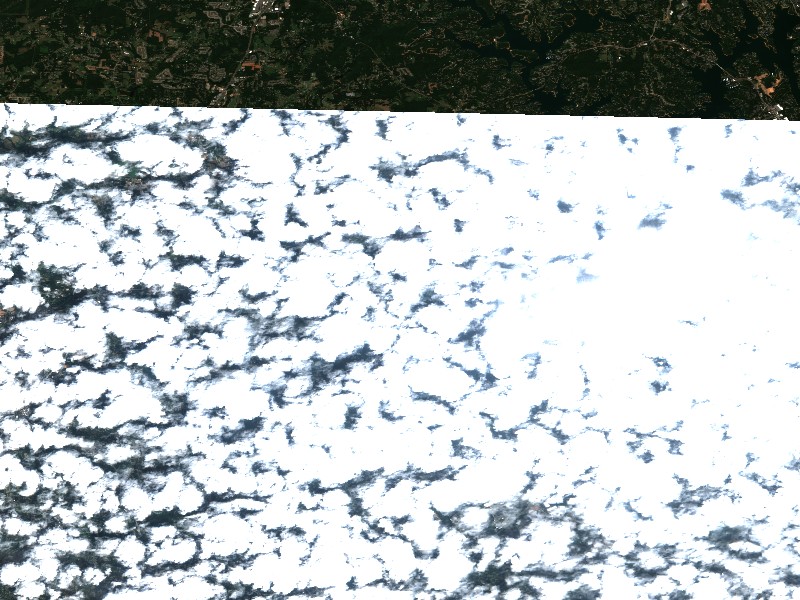
A true-colour image from the most recent low-cloud Sentinel-2 pass over the lake. It shows the lake as it looked on the capture date, not today.

Captured 2026-10-27 (0% cloud cover in scene)
Sentinel-2 true-colour satellite image of Lake Lanier captured 2026-10-27
10 m/px β€’ Level-2A surface reflectanceOpen full image β†—

Contains modified Copernicus Sentinel data 2026, processed via the Copernicus Data Space Ecosystem.

Living Near Lake Lanier

Shoreline and docks. Shoreline use on Lake Lanier is managed by U.S. Army Corps of Engineers, Mobile District. Whether private docks are allowed, and where, depends on that operator's shoreline rules. Before making an offer on waterfront property, confirm with the operator whether a dock permit exists and whether it transfers to a new owner.

Flood pool and easements. Property near the water may carry flowage easements that limit building below a set elevation. Check the deed, a survey and the operator's rules before buying.

Nearby towns. Buford, GA, Gainesville, GA, Cumming, GA. Property taxes, utilities, HOA covenants and short-term rental rules vary between towns and counties.

Lakefront Living & Property

Living on Lake Lanier

Considering a lake cabin, waterfront home, or retirement property on Lake Lanier? Water levels, dock permits, and flood pool limits all affect waterfront property, so review them before you buy.

πŸ“

Buford, GA

πŸ“

Gainesville, GA

πŸ“

Cumming, GA

πŸ“

Flowery Branch, GA

Nearby Lakes

647.62 ft MSL Observed level
Updated
Seasonal target: 658.68 ft Β· U.S. Army Corps of Engineers (SAS) Β· checked 2026-11-04 Β· schedule 2026-01-01 through 2026-12-31
24h change: -0.06 ft
Lake Hartwell water level
593.93 ft MSL Observed level
Updated
24h change: 0.05 ft
Lake Guntersville water level
638.47 ft MSL Below normal
Updated
-12.53 ft vs normal pool (651.00 ft) U.S. Army Corps of Engineers (LRN) Β· checked 2026-11-04
24h change: -0.10 ft
Dale Hollow Lake water level
756.73 ft MSL Below normal
Updated
-3.27 ft vs full pond (760.00 ft) Duke Energy (NRC environmental report) Β· checked 2026-11-01
24h change: -0.06 ft
Lake Norman water level
691.07 ft MSL Below normal
Updated
-31.93 ft vs normal pool (723.00 ft) U.S. Army Corps of Engineers (LRN) Β· checked 2026-11-04
24h change: -0.26 ft
Lake Cumberland water level
354.82 ft MSL Observed level
Updated
24h change: 0.03 ft
Kentucky Lake water level
454.82 ft MSL Observed level
Updated
Seasonal target: 462.04 ft Β· U.S. Army Corps of Engineers (SWL) Β· checked 2026-11-04 Β· schedule 2026-01-01 through 2026-12-31
24h change: 0.10 ft
Greers Ferry Lake water level

Weekend trip planning: Lakes Near Atlanta, GA