
Lake Hartwell
U.S. Army Corps of Engineers, Savannah District • 56,000 surface acres • 962 miles of shoreline
Lake Hartwell
Lake-specific guide · Agency-sourced
Lake Hartwell: 962 miles of shoreline on the Savannah River state line
The second Savannah River reservoir
Lake Hartwell sits on the South Carolina-Georgia state line on the Savannah River. The South Carolina DNR’s Lake Hartwell description calls it one of the most popular lakes in the Southeast and says it is the second U.S. Army Corps of Engineers reservoir built on the Savannah River. The DNR lists 56,000 acres of water, 962 miles of shoreline, an average depth of 45 feet, a maximum depth of 185 feet, 45 boat ramps and 11 fish attractors, and says the Corps owns and manages it. The same page says the lake is surrounded by more than 23,000 acres of public land, and names Anderson, Oconee and Pickens counties in South Carolina.
On the water, the normal pool is 660.0 feet and the flood pool 665.0 feet, per the Corps’ observed elevation series for the lake. That five-foot band matters: most of the shoreline infrastructure is built for high water, and ramp usability shifts as the level moves, so check the live level before you plan a trip.
A black bass playground, on both sides of the line
The DNR page describes Hartwell as a fishing hotspot for three species of black bass, striped bass, hybrid bass, black crappie and bream, and the Corps’ Hartwell fishing page (read from an April 2026 archive snapshot because the live page blocks automated fetches) says the same: largemouth bass, bream, crappie, catfish, striped bass and hybrid bass. The Corps page adds that habitat work includes maintaining deep and shallow fish attractors and felling trees into the water along the shoreline, and it reminds tournament organizers that a Special Event Permit may be needed for events larger than 10 boats.
Because the lake straddles the state line, the state you fish from determines the regulations; the Corps page links to both the Georgia and South Carolina state fishing rules, and each state sets its own limits. Read the current rules for the state side you launch from before you keep fish.
Camping at the reservoir’s most-used points
The Corps runs a number of campgrounds and day-use areas around the lake, all listed on Recreation.gov. Springfield, near the dam on the Georgia side, is described in its listing as one of Hartwell’s most popular camping destinations: 60 acres of mostly Virginia pine with 79 public campsites, a boat ramp, a courtesy dock, and a designated swim area. Elrod Ferry is a 39-acre day-use and boat-launch site on a point overlooking the lake near Hartwell Dam, with 37 picnic sites and three designated swim areas, and its listing notes the area sees intense public use in peak season. Watsadler, per its listing, is a 36-acre open-year-round campground that the listing also calls one of Hartwell’s most popular camping destinations. Rates, reservations and gate hours change by season, so confirm them on each Recreation.gov listing before you drive out.
The dam end and the reservoir’s public land
Hartwell Dam holds the upper end of the lake, and the Corps operates the visitor center and project manager’s office there; the fishing page above notes its seasonal hours and that park rangers are on duty throughout the year. The Corps’ page also warns that the area below the dam can rise quickly when the generators run, with a horn sounded before generation begins that is only heard within about a mile of the dam.
The DNR description’s note about 23,000-plus acres of surrounding public land is the hook for shore-based trips: in addition to the Corps recreation areas, the lake is bordered by a set of South Carolina state parks, including Hart, Tugaloo and Sadlers Creek, which the Recreation.gov directory lists as part of the Hartwell Lake recreation system. Those parks add campgrounds and additional access points on the South Carolina shoreline, each with its own current hours and reservations.
Sources reviewed October 2026. Check current levels and operator notices before visiting.
Lake Hartwell Boat Ramps, Campgrounds & Marinas
Each site below links to the official listing it came from. Ramp closures depend on each ramp's design and the lake level, and most operators don't publish them in real time, so confirm with U.S. Army Corps of Engineers, Savannah District before you launch.
Campgrounds & RV Parks
Campgrounds listed by Recreation.gov and official park sources⛺ Big Oaks
Check with operatorBig Oaks Recreation Area is a 12 acre gently sloping site with good grass cover and scattered pine and hardwood trees throughout.. . . The area experiences high levels of intense public use during peak recreatio...
⛺ Broyles
Check with operatorBroyles Recreation Area consists of 24 acres with a gentle to moderate slope and vegetation consisting primarily of pine. The site presently offers day use and boat launching facilities consisting of 1 volunteer...
⛺ Coneross Park
Check with operatorConeross Campground is a moderately sloping, heavily wooded 136 acre site of mixed hardwoods and pines. The site presently offers camping and boat launching facilities to include: 1 gatehouse/entrance, 2 park at...
⛺ Crescent
Check with operatorMUST BE RESERVED A MINIMUM OF TWO DAYS IN ADVANCE OF ARRIVAL DATE. Crescent Group Campground is a 41 acre site located on a narrow peninsula with gentle slopes and a scattered tree cover of pine and mixed hardwo...
⛺ Elrod Ferry
Check with operatorElrod Ferry Recreation Area is a 39 acre site situated on a gently sloping point that overlooks the lake near Hartwell Dam. The site presently offers day use and boat launching facilities consisting of 1 gatehou...
⛺ Lake Hartwell Camping And Cabins
Check with operator⛺ Oconee Point
Check with operatorOconee Point Campground consists of 70 acres of gently sloping area with a relatively dense cover of pines and mixed hardwoods. . The site presently offers camping and boat-launching facilities including 1 gateh...
⛺ Singing Pines
Check with operatorSinging Pines Recreation Area consists of 42 acres. The site presently offers day-use and boat-launching facilities consisting of 1 gatehouse/entrance, 57 picnic sites, 2 standard picnic shelters with water and ...
⛺ Springfield
Check with operatorSpringfield Campground is one of Hartwell’s most popular camping destinations consisting of 60 acres of primarily Virginia pine and some mixed hardwoods. The area presently offers 1 gatehouse/entrance, 2 park at...
⛺ Watsadler
Check with operatorWatsadler Campground is a 36 acre site consisting of a relatively dense cover of pine and mixed hardwoods. The area is open year-round and is one of Hartwell’s most popular camping destinations. The site present...
Marinas
Marinas on the lake. Contact each marina for services and rates.⚓ Big Water Marina
⚓ Portman Marina
Parks & Day-Use Areas
Listed by Recreation.gov. Facilities vary; check each park's page for boat launch access.🌳 Hart State Park
🌳 Lake Hartwell State Park
🌳 Sadlers Creek St. Pk
🌳 Tugaloo State Park
Fishing Lake Hartwell
Lake Hartwell Fishing Report
Waning Crescent (21% illuminated); strongest solunar period: Moon Overhead 7:43 AM–9:43 AM EST; lake at 647.62 ft, down 0.06 ft in 24 hours.
Fishing & Boating Rules
Official SourcesLimits, licenses, and boating requirements change often, and border lakes can have their own rules. Check the current official rules before fishing or boating on Lake Hartwell:
Report Conditions on Lake Hartwell
Seen a hazard, a ramp closure, or changing water clarity? Reports go to LakeWatchers for review.
Were you on the water today?
Tell us about water clarity, ramp conditions, or hazards. We review reports and use them to correct the information on this page.
Latest Satellite Image of Lake Hartwell
A true-colour image from the most recent low-cloud Sentinel-2 pass over the lake. It shows the lake as it looked on the capture date, not today.
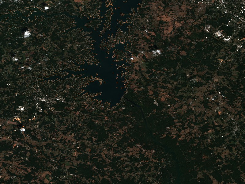
Contains modified Copernicus Sentinel data 2026, processed via the Copernicus Data Space Ecosystem.
Commercial Marinas & Featured Partners on Lake Hartwell
Marinas from official listings, plus open spots for local guides and rental operators.
⚓ Big Water Marina
⚓ Portman Marina
Charter Guide or Boat Rental on Lake Hartwell?
Reach boaters and anglers checking water levels and boat ramp listings before heading to Lake Hartwell.
Living Near Lake Hartwell
Shoreline and docks. Shoreline use on Lake Hartwell is managed by U.S. Army Corps of Engineers, Savannah District. Whether private docks are allowed, and where, depends on that operator's shoreline rules. Before making an offer on waterfront property, confirm with the operator whether a dock permit exists and whether it transfers to a new owner.
Flood pool and easements. Property near the water may carry flowage easements that limit building below a set elevation. Check the deed, a survey and the operator's rules before buying.
Nearby towns. Anderson, SC, Clemson, SC, Hartwell, GA. Property taxes, utilities, HOA covenants and short-term rental rules vary between towns and counties.
Living on Lake Hartwell
Considering a lake cabin, waterfront home, or retirement property on Lake Hartwell? Water levels, dock permits, and flood pool limits all affect waterfront property, so review them before you buy.
Clemson, SC
Anderson, SC
Hartwell, GA
Seneca, SC
Nearby Lakes
Dale Hollow Lake
TN/KYKentucky Lake
TN/KYWeekend trip planning: Lakes Near Atlanta, GA