
Lake Whitney
U.S. Army Corps of Engineers, Fort Worth District • Impounded 1951 • 23,500 surface acres
Lake-specific guide · Agency-sourced
Lake Whitney: Brazos bluffs, striped bass and separate park launches
A Brazos reservoir with distinct shores
Lake Whitney impounds the Brazos and Nolan rivers northwest of Waco. Texas Parks and Wildlife Department (TPWD) lists a 1951 impoundment, 23,500 surface acres and a 533-foot conservation-pool elevation. The U.S. Army Corps of Engineers is the controlling authority. These reference figures help describe the lake, while the dated level observation on this page shows where the water stood when the gauge reported. Neither tells a visitor whether a particular ramp has enough water or whether a park is open today.
The lake’s physical variety is central to its fishing and boating choices. TPWD describes natural rock shorelines with steep bluffs and boulders, along with sand and gravel flats. Submerged timber and flooded vegetation add other kinds of cover. A route beside a bluff and a route into a wooded cove call for different attention to wind, depth and submerged obstacles; a single lake-wide condition label cannot describe both.
Fish habitat and seasonal patterns
The TPWD fishing profile names striped and white bass, smallmouth and largemouth bass, crappie, and several catfish among the predominant species. It describes spring striped-bass fishing in the reservoir and bank-fishing opportunities on the Nolan and Brazos rivers above it. During summer, the agency notes stratification and different locations for stripers in the middle and lower lake. These are long-running patterns, not a forecast of where fish will be during a particular trip.
TPWD also documents six constructed freshwater reefs: three near Uncle Gus’ Marina in South Fork Rocky Creek and three in coves near Lake Whitney State Park. Its habitat-structure viewer supplies mapped locations. A reef description is not a safe navigation route or a current catch report. Use the lake page’s report link for recent fishing information and the agency’s regulation link for rules that may change.
Choosing a place to enter the water
McCown Valley is a Corps campground on the east side of the lake. Plowman Creek, on the upper west side, has a federal listing that identifies a boat ramp and camping. Lake Whitney State Park is a separate TPWD destination with lake access. Their locations make them different starting points rather than interchangeable names for one shoreline. The TPWD access directory lists the corresponding launch areas and directions.
The TPWD 2023 ramp survey provides coordinates for McCown Valley, Plowman Creek and the state park. The survey is a traceable basis for map pins, but the conditions it observed were tied to September 2023 and that day’s reservoir elevation. They are not current ramp status. TPWD’s access page itself cautions that some areas may be closed after high water or flood damage, so check the Corps or park operator before towing a boat there.
A useful check before departure
TPWD describes Whitney’s typical clarity as stained and notes that golden-alga blooms can occur. Its lake profile directs readers to current bloom information; avoid treating an older description as a present advisory. Compare the observed pool reading and timestamp with the conservation reference, then check weather, the chosen park’s notice and any current access warning. On a lake with river arms, rock banks and separate managed parks, a verified destination and a recent condition report make the trip plan more dependable.
Sources reviewed October 2026. Check current levels and operator notices before visiting.
Lake Whitney Boat Ramps, Campgrounds & Marinas
Each site below links to the official listing it came from. Ramp closures depend on each ramp's design and the lake level, and most operators don't publish them in real time, so confirm with U.S. Army Corps of Engineers, Fort Worth District before you launch.
Boat Ramps & Launches
Public launches, lane counts, fees, and federal pass info. Confirm ramp status with the operator before launching.🚤 Lake Whitney State Park Boat Ramp
Check StatusRamp coordinates from TPWD 2023 fisheries survey; condition and access may have changed. Check the operator before travel.
🚤 McCown Valley Park Boat Ramp
Check StatusRamp coordinates from TPWD 2023 fisheries survey; condition and access may have changed. Check the operator before travel.
🚤 Plowman Creek Park Boat Ramp
Check StatusRamp coordinates from TPWD 2023 fisheries survey; condition and access may have changed. Check the operator before travel.
🚤 Walling Bend Park Boat Ramp
Check StatusUSACE park with one double-lane ramp.
Campgrounds & RV Parks
Campgrounds listed by Recreation.gov and official park sources⛺ Mccown Valley
Check with operatorMcCown Valley is located on Whitney Lake on the main channel of the Brazos River in Central Texas. Over two million people visit Whitney Lake each year to enjoy the plethora of recreational activities and scenic...
Parks & Day-Use Areas
Listed by Recreation.gov. Facilities vary; check each park's page for boat launch access.🌳 Lake Whitney State Park
Fishing Lake Whitney
Lake Whitney Fishing Report
Waning Crescent (20% illuminated); strongest solunar period: Moon Overhead 7:43 AM–9:43 AM CST; lake at 530.40 ft, 2.6 ft below normal pool, steady over 24 hours.
Fishing & Boating Rules
Official SourcesLimits, licenses, and boating requirements change often. Check the current official rules before fishing or boating on Lake Whitney:
Report Conditions on Lake Whitney
Seen a hazard, a ramp closure, or changing water clarity? Reports go to LakeWatchers for review.
Were you on the water today?
Tell us about water clarity, ramp conditions, or hazards. We review reports and use them to correct the information on this page.
Latest Satellite Image of Lake Whitney
A true-colour image from the most recent low-cloud Sentinel-2 pass over the lake. It shows the lake as it looked on the capture date, not today.
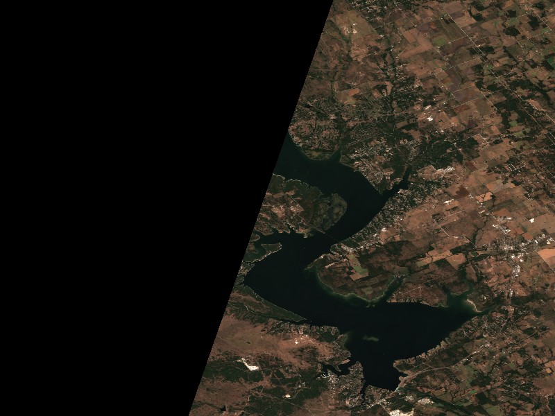
Contains modified Copernicus Sentinel data 2026, processed via the Copernicus Data Space Ecosystem.
Commercial Marinas & Featured Partners on Lake Whitney
Marinas from official listings, plus open spots for local guides and rental operators.
Featured Fishing Guides on Lake Whitney
Are you a licensed fishing guide or charter captain on Lake Whitney? Feature your guide service on the Lake Whitney page next to its fishing section.
Marinas & Boat Rentals on Lake Whitney
Connect directly with lake homeowners and visiting boaters searching for pontoon rentals, boat slips, dry storage, and marine service.
Living Near Lake Whitney
Shoreline and docks. Shoreline use on Lake Whitney is managed by U.S. Army Corps of Engineers, Fort Worth District. Whether private docks are allowed, and where, depends on that operator's shoreline rules. Before making an offer on waterfront property, confirm with the operator whether a dock permit exists and whether it transfers to a new owner.
Flood pool and easements. The normal pool is 533.00 ft MSL and the flood pool reaches 571.00 ft MSL, a 38 ft difference. Property near the water may carry flowage easements that limit building below a set elevation. Check the deed, a survey and the operator's rules before buying.
Nearby towns. Whitney, TX, Clifton, TX, Hillsboro, TX, Waco, TX. Property taxes, utilities, HOA covenants and short-term rental rules vary between towns and counties.
Living on Lake Whitney
Considering a lake cabin, waterfront home, or retirement property on Lake Whitney? Water levels, dock permits, and flood pool limits all affect waterfront property, so review them before you buy.
Whitney, TX
Clifton, TX
Nearby Lakes
Weekend trip planning: Lakes Near Dallas-Fort Worth, TX