
Cedar Creek Lake
Tarrant Regional Water District • Impounded 1965 • 32,623 surface acres
Cedar Creek Lake
Fishing Cedar Creek Lake
Cedar Creek Lake Fishing Report
Waning Crescent (20% illuminated); strongest solunar period: Moon Overhead 7:38 AM–9:38 AM CST; lake at 315.78 ft, 6.2 ft below normal pool, steady over 24 hours.
Fishing & Boating Rules
Official SourcesLimits, licenses, and boating requirements change often. Check the current official rules before fishing or boating on Cedar Creek Lake:
Report Conditions on Cedar Creek Lake
Seen a hazard, a ramp closure, or changing water clarity? Reports go to LakeWatchers for review.
Were you on the water today?
Tell us about water clarity, ramp conditions, or hazards. We review reports and use them to correct the information on this page.
Latest Satellite Image of Cedar Creek Lake
A true-colour image from the most recent low-cloud Sentinel-2 pass over the lake. It shows the lake as it looked on the capture date, not today.
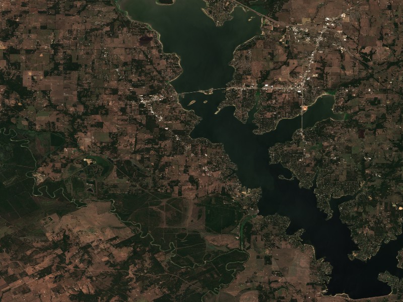
Contains modified Copernicus Sentinel data 2026, processed via the Copernicus Data Space Ecosystem.
Commercial Marinas & Featured Partners on Cedar Creek Lake
Marinas from official listings, plus open spots for local guides and rental operators.
Featured Fishing Guides on Cedar Creek Lake
Are you a licensed fishing guide or charter captain on Cedar Creek Lake? Feature your guide service on the Cedar Creek Lake page next to its fishing section.
Marinas & Boat Rentals on Cedar Creek Lake
Connect directly with lake homeowners and visiting boaters searching for pontoon rentals, boat slips, dry storage, and marine service.
Living Near Cedar Creek Lake
Shoreline and docks. Shoreline use on Cedar Creek Lake is managed by Tarrant Regional Water District. Whether private docks are allowed, and where, depends on that operator's shoreline rules. Before making an offer on waterfront property, confirm with the operator whether a dock permit exists and whether it transfers to a new owner.
Flood pool and easements. Property near the water may carry flowage easements that limit building below a set elevation. Check the deed, a survey and the operator's rules before buying.
Nearby towns. Gun Barrel City, TX, Mabank, TX, Eustace, TX, Kemp, TX. Property taxes, utilities, HOA covenants and short-term rental rules vary between towns and counties.
Living on Cedar Creek Lake
Considering a lake cabin, waterfront home, or retirement property on Cedar Creek Lake? Water levels, dock permits, and flood pool limits all affect waterfront property, so review them before you buy.
Gun Barrel City, TX
Mabank, TX
Nearby Lakes
Weekend trip planning: Lakes Near Dallas-Fort Worth, TX