If you're towing a boat to Lake Powell this week, the water level matters more than the calendar. Glen Canyon Dam elevation sits near 3,517 feet, and at that level most of the lake's launch ramps sit below their published minimum safe elevation. That means the honest answer for most boaters right now is that only one or two ramps offer motorized access, while several others allow paddlecraft or carry an "at your own risk" label from the National Park Service.
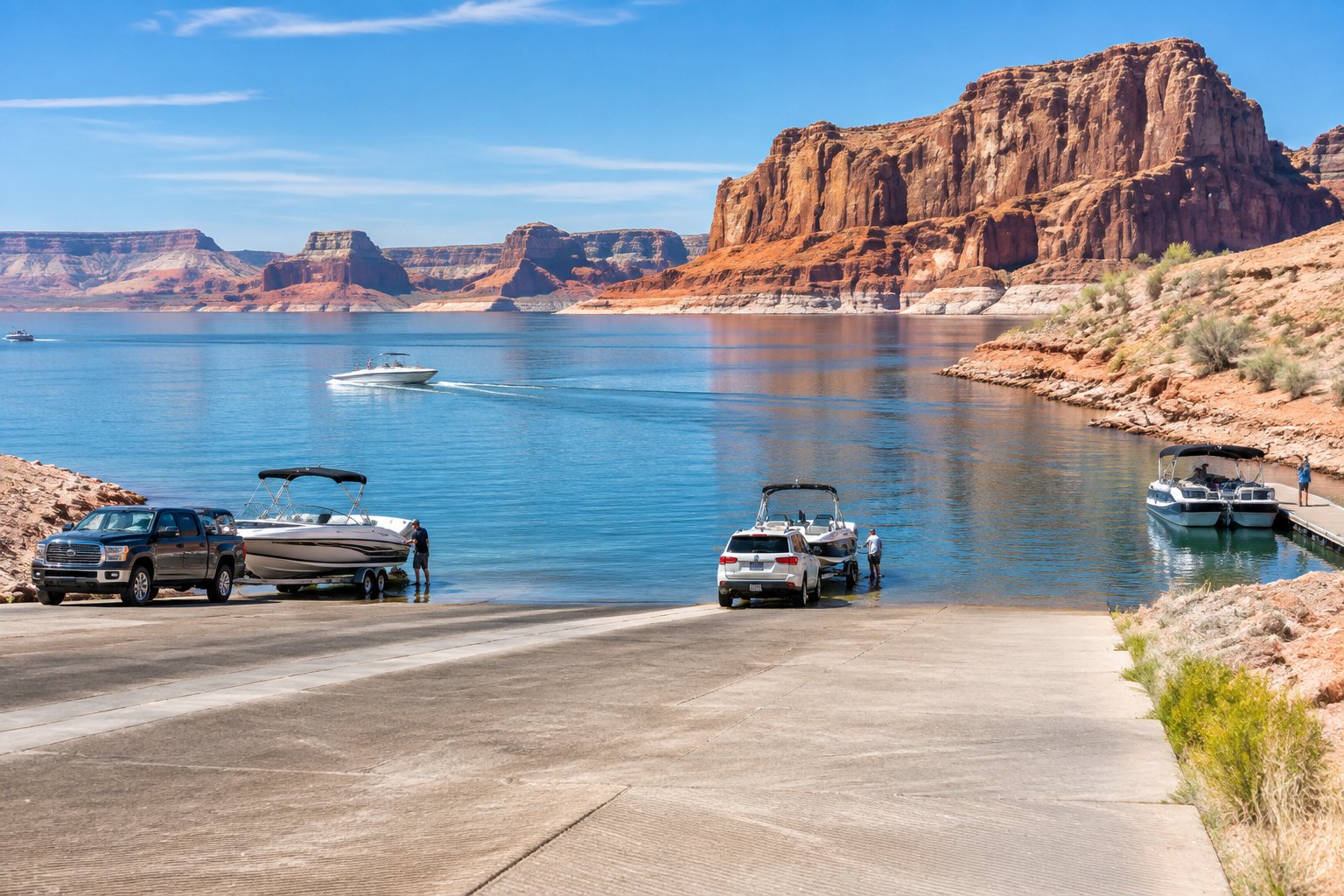
Wahweap Stateline Auxiliary and Bullfrog North are the two ramps most likely to support motorized launching at today's elevation, while Wahweap Main, Antelope Point Public, and most Halls Crossing lanes remain closed or paddlecraft-only until levels rise. Conditions shift by the week at Lake Powell, so check the live elevation and ramp-by-ramp status on LakeWatchers the morning you plan to launch, before you hitch up the trailer and drive out to Glen Canyon National Recreation Area.
Which Launches Can You Use Today?
Ramp access at Lake Powell tracks the reservoir's elevation, not the season or a fixed operating schedule. The National Park Service, working with elevation data from the USGS and USBR, updates ramp status as the lake rises or falls, and a ramp that supported motorized boats last month can drop to paddlecraft-only within weeks.
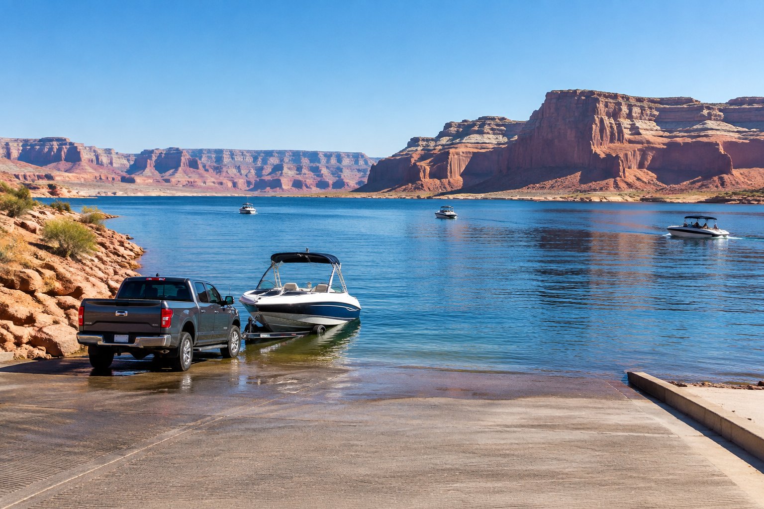
Check the Current Elevation Before You Tow
Lake Powell's current elevation sits near 3,517 feet, well below the level most ramps were engineered for. Each ramp has its own minimum safe elevation published by the NPS, and a difference of a few feet can shift a ramp from usable to closed. Compare the current reading against each ramp's threshold before leaving home, since driving out on outdated information wastes a trip.
What "Open," "Limited," and "At Your Own Risk" Mean
"Open" means the ramp surface reaches the water and the NPS considers it safe for the vessel types listed. "Limited" usually restricts access to paddlecraft like kayaks or paddleboards, or caps vessel length. "At your own risk" means the ramp technically reaches water, but the surface, drop-off, or approach carries hazards the NPS has not corrected. Boat rentals and marina staff can confirm which label applies on a given day.
Motorized Vessels, Houseboats, and Paddlecraft Have Different Access
Houseboats and larger motorized boats need more ramp length and a firmer surface than a kayak or paddleboard. A ramp closed to motorized vessels can remain open for boating with paddlecraft, since these boats launch from shallower, unimproved shoreline. Confirm your specific vessel type against the posted status before towing, since a ramp listed as "limited" may not accommodate a houseboat.
Ramp Conditions From Wahweap to Hite
Ramp status varies significantly across Lake Powell's roughly 186-mile length, from Wahweap near the Arizona-Utah line to Hite far up the Colorado River arm. Wahweap and Antelope Point sit toward the south end near Glen Canyon Dam, while Bullfrog, Halls Crossing, and Hite serve the mid-lake and upper-lake areas in Utah.
Wahweap Main and Stateline Auxiliary Access
Wahweap Stateline Auxiliary currently functions as the primary motorized launch point on the south end of the lake. It has operated a few feet above its cutoff elevation, with plate mats installed near the ramp's end to extend usable surface as the water recedes. Wahweap Main, by contrast, sits closed to motorized launching at today's level, so boaters headed to the south end should plan on Stateline Auxiliary rather than the main ramp.
Antelope Point Public and Business Ramp Options
Antelope Point Public Launch Ramp has closed due to low water at various points this season, leaving the Antelope Point Business Ramp as the more consistent option near that marina. Antelope Point Valet Services can also handle launch and retrieval for boaters who prefer not to back a trailer down a marginal ramp. Call ahead to confirm which ramp is active before arriving, since status here has changed multiple times.
Bullfrog Main, Bullfrog North, and the UDOT Launch Ramps
Bullfrog North has functioned as one of the few motorized ramps still usable uplake, though only the west lane is typically active, with a steel plate installed at the ramp's end and a drop-off hazard just beyond it. Vessels under 25 feet are preferred there given the limited surface. Bullfrog Main has closed as water has receded from the original marina site, prompting the UDOT launch ramps and a relocated marina area to pick up demand near Halls Crossing.
Halls Crossing, the UDOT Ferry, and Hite Closures
Halls Crossing has seen reduced motorized access as the lake has dropped, with several lanes limited to paddlecraft or closed outright. The UDOT ferry connecting Halls Crossing and Bullfrog continues to operate as a vehicle and passenger link across the lake, separate from boat ramp status. Hite, at the upper end of the lake, has closed to motorized launching for extended periods, though a temporary ramp has helped preserve some access for the recreation area as the main site became unusable.
Why Castle Rock Cut Can Be Closed Even When You Can Launch
Castle Rock Cut is a navigation channel, not a launch ramp, and its status is a separate question from whether you can put a boat in the water. Low elevation can close the Cut to boat traffic even when nearby ramps remain open, forcing boaters to take a longer route around Castle Rock to reach other parts of the lake. Check Cut status alongside ramp status if your trip depends on that shortcut. For a broader look at how low water reshapes navigation on a major reservoir, the ramp guide for Lake Mead covers a comparable situation downstream.
Marinas, Navigation, and On-Water Services
Marina services at Lake Powell have adjusted alongside falling water levels, with some facilities relocating and others reducing hours or capacity. Wahweap, Antelope Point, and Bullfrog remain the most fully staffed marinas, while Halls Crossing and Dangling Rope Marina offer a narrower set of services.
What Services Are Available at Wahweap, Antelope Point, and Bullfrog
Wahweap Marina, Antelope Point Marina, and Bullfrog Marina offer the widest range of services on the lake, including housekeeping units, campgrounds, showers, gift shops, and boat repair. Lake Powell Resorts & Marinas, the park concessioner, also runs grocery stores, laundry facilities, and boat rentals at these locations. Fueling and dry storage remain available at these three marinas, though hours can shift with staffing and demand.
Halls Crossing Services and Cross-Lake Travel Limits
Halls Crossing Marina offers a smaller service set than the three larger marinas, with fuel and basic supplies available but less lodging capacity. The UDOT ferry between Halls Crossing and Bullfrog remains the practical way to move a vehicle across the lake without a long drive around. Boaters relying on Halls Crossing for fuel or supplies should confirm current hours, since service levels there have narrowed as the lake has dropped.
Fuel, Pumpout, and Restroom Planning on the Water
Fuel availability concentrates at Wahweap, Antelope Point, and Bullfrog, so top off before heading toward less-serviced parts of the lake. A free boat pumpout station and dump station are available at developed marina areas, an important stop before or after a houseboat trip. Floating restrooms and portable toilets are placed at popular anchorages, but their number has been reduced in some bays as those areas have gone dry.
Navigation Considerations for Rainbow Bridge and Padre Bay
Rainbow Bridge National Monument remains reachable by boat, though the approach distance from open water has grown as the lake has receded, and low-clearance areas near the monument require careful navigation. Padre Bay and Good Hope Bay have seen shoreline shift substantially, exposing sandbars and rock features not visible at higher lake levels. Run these areas at reduced speed and keep a chart or GPS chartplotter current rather than relying on memory from a prior trip.
Prepare for a Low-Water Launch
A safe Lake Powell launch at today's elevation takes more preparation than a normal boat ramp visit. Vessel size, ramp surface conditions, and a clear retrieval plan matter as much as checking the weather forecast.
Confirm Vessel Size, Ramp Surface, and Retrieval Plans
Match your vessel to the ramp's posted limits before backing down, since a ramp rated for boats under 25 feet may not safely handle a larger cruiser or houseboat. Steel plates and mats used to extend ramp surfaces can be slick when wet, so low-range gearing and a steady approach help on retrieval. Have a backup plan, since a ramp that worked in the morning can become congested or unusable by afternoon if lake conditions shift.
Follow Lake Powell Boating Regulations and Safety Rules
United States Coast Guard equipment requirements apply on Lake Powell just as they do on any federal waterway, and Utah State Parks and the NPS both enforce boating regulations within their jurisdictions. Personal watercraft and cruisers need proper registration and safety gear before launching. Speed limits near Castle Rock Cut and other narrow channels exist for a reason given how shallow water has exposed new obstacles.
Prevent Quagga Mussel Spread Before Leaving the Lake
Clean, drain, and dry your boat before leaving Lake Powell to avoid spreading quagga mussels to other waters. Utah and Arizona both enforce inspection requirements at certain access points, and skipping this step can carry fines. This step protects other lakes your boat visits next, including any water body outside the Glen Canyon Dam watershed.
When to Call the NPS or a Marina Before Departure
Call the marina nearest your planned launch point or check the NPS Changing Lake Levels page the morning of your trip, since ramp status can change faster than most travel guides update. This single call can save a wasted drive to a ramp that closed overnight. For same-day accuracy, cross-check the live elevation and ramp list on LakeWatchers alongside the NPS source before you commit to a route.
Plan Around Conditions, Not a Fixed Ramp List
Lake Powell doesn't have a permanent set of "open" ramps, and treating any list as fixed is the biggest mistake boaters make. Changing lake levels mean ramp status is a snapshot, current on the day it's published and potentially outdated within a week or two.
The practical approach is to check the current elevation first, then match that number against the specific ramp you plan to use, rather than relying on a general impression that "Lake Powell is open" or "closed." A ramp's individual minimum elevation, not the lake's overall reputation, determines whether your trailer reaches usable water. Build that check into trip planning the same way you'd check weather, every time, not just once per season.
Frequently Asked Questions
What boat ramps are open at Lake Powell today?
Ramp status changes with elevation, so confirm the specific ramp count and names on the morning of your trip rather than relying on a fixed list. At recent low elevations, only one or two ramps, typically Wahweap Stateline Auxiliary and Bullfrog North, have supported motorized launching, with several others limited to paddlecraft.
Can I launch a motorized boat at Wahweap or Stateline?
Wahweap Stateline Auxiliary has functioned as the main motorized launch point on the south end of the lake at current low elevations, while Wahweap Main has closed to motorized boats. Plate mats extend the usable surface at Stateline, but conditions there can shift with the water level, so confirming status before you tow is worthwhile.
Is the Bullfrog North ramp safe for larger boats?
Bullfrog North has operated with a west-lane-only configuration and a drop-off hazard near the ramp's end, making it better suited to vessels under 25 feet. Larger boats and houseboats face more risk launching there given the limited surface and steel plate extension. Call the marina to confirm current limits before attempting a larger vessel.
Are Halls Crossing and the Lake Powell ferry operating?
The UDOT ferry between Halls Crossing and Bullfrog continues carrying vehicles and passengers across the lake, separate from boat ramp status. Halls Crossing's boat ramps have seen reduced motorized access as water levels dropped, with some lanes limited to paddlecraft only.
Can I still reach Rainbow Bridge when Lake Powell is low?
Rainbow Bridge National Monument remains reachable by boat, though the distance from open water to the monument has increased as the lake has receded. Navigation near the approach requires more caution due to shallow areas and exposed rock that weren't visible at higher lake levels.
Are Lake Powell boat ramps open during a government shutdown?
Ramp access during a federal government shutdown depends on National Park Service staffing decisions made at the time, which can limit visitor services even if the water level would otherwise support launching. Checking directly with Glen Canyon National Recreation Area or the NPS website before a trip is the only reliable way to confirm operating status during a shutdown.