
Keystone Lake
USACE Tulsa District • Built 1964 • 26,000 surface acres • 330 miles shoreline
Keystone Lake
Great Day on the Water
Level is right at normal conservation pool (-0.7 ft), water temp is a comfortable 81°f, moderate chop with 10 mph winds, no active algae or safety advisories.
What to Know About Keystone Lake
Located just 20 minutes west of downtown Tulsa. Appalachia Bay ORV area offers 1,300 acres of sandy trails right on the water. Great striped bass fishery below the dam on the Arkansas River.
Boat Ramps & Launches
Public concrete launches, usable lake elevations, and federal pass info🚤 Appalachia Bay
Usable (Level OK)Public boat launch facility providing direct water access with vehicle and boat trailer parking.
🚤 Appalachia Bay Day Use
Usable (Level OK)Public boat launch facility providing direct water access with vehicle and boat trailer parking.
🚤 Blackdog Park Boat Ramp
Usable (Level OK)Public recreation park offering lakefront shoreline access, picnic areas, and boat launch facilities.
🚤 Brush Creek
Usable (Level OK)Public boat launch facility providing direct water access with vehicle and boat trailer parking.
🚤 Bull Creek Boat Ramp
Usable (Level OK)Public boat launch facility providing direct water access with vehicle and boat trailer parking.
🚤 Bull Creek Peninsula
Usable (Level OK)Public boat launch facility providing direct water access with vehicle and boat trailer parking.
🚤 Cowskin Bay South - Westport
Usable (Level OK)Public boat launch facility providing direct water access with vehicle and boat trailer parking.
🚤 Crosstimbers Marina
Usable (Level OK)Full-service marina providing vessel mooring, slip rentals, fuel dock, and visitor services.
🚤 Crystal Bay Marina
Usable (Level OK)Full-service marina providing vessel mooring, slip rentals, fuel dock, and visitor services.
🚤 Feyodi Creek
Usable (Level OK)Public boat launch facility providing direct water access with vehicle and boat trailer parking.
🚤 Heyburn Park Day Use
Usable (Level OK)Public recreation park offering lakefront shoreline access, picnic areas, and boat launch facilities.
🚤 Hominy Landing Boat Ramp
Usable (Level OK)Public boat launch facility providing direct water access with vehicle and boat trailer parking.
🚤 Keystone Ramp
Usable (Level OK)Public boat launch facility providing direct water access with vehicle and boat trailer parking.
🚤 Keystone State Park
Usable (Level OK)Public recreation park offering lakefront shoreline access, picnic areas, and boat launch facilities.
🚤 New Mannford Ramp
Usable (Level OK)Public boat launch facility providing direct water access with vehicle and boat trailer parking.
🚤 Osage Park Boat Ramp
Usable (Level OK)Public recreation park offering lakefront shoreline access, picnic areas, and boat launch facilities.
🚤 Sheppard Point Day Use
Usable (Level OK)Public boat launch facility providing direct water access with vehicle and boat trailer parking.
🚤 Skiatook Point Boat Ramp
Usable (Level OK)Public boat launch facility providing direct water access with vehicle and boat trailer parking.
🚤 Sunset Bay
Usable (Level OK)Public boat launch facility providing direct water access with vehicle and boat trailer parking.
🚤 Sunset Bay Day Use
Usable (Level OK)Public boat launch facility providing direct water access with vehicle and boat trailer parking.
🚤 Tall Chief Cove Day Use
Usable (Level OK)Public boat launch facility providing direct water access with vehicle and boat trailer parking.
🚤 Twin Points Day Use
Usable (Level OK)Public boat launch facility providing direct water access with vehicle and boat trailer parking.
🚤 Walnut Creek Day Use Pass
Usable (Level OK)Public boat launch facility providing direct water access with vehicle and boat trailer parking.
🚤 Washington Irving South Day Use Pass
Usable (Level OK)Waterfront camping facility offering tent and RV campsites with scenic lake views and recreational access.
Campgrounds & RV Parks
Official federal, Corps of Engineers & state park campsites⛺ Appalachia Bay Recreation Area
$18 - $32 / nightWelcome to Appalachia Bay! Located south of US 412 just 20 miles west of Tulsa, this park features a boat ramp, camping, fishing and other water sports, and a 400 acre off road park. The lake's blue-green water,...
⛺ Brush Creek Public Use Area
$18 - $32 / nightBrush Creek is located downstream of Keystone Dam, just 10 minutes from Tulsa, Oklahoma. This park features campground provided activities such as horseshoes, cornhole, a basketball court, a sand volleyball cour...
⛺ Heyburn Park
$18 - $32 / nightHeyburn Park features 46 campsites, a 2 lane boat ramp, courtesy dock, playground, 2 restroom/shower facilities, 2 group shelters, and a large swim beach with picnic tables. Recreation Boating, water skiing and ...
⛺ Sheppard Point
$18 - $32 / nightSheppard Point is an excellent destination for access to Oklahoma's Heyburn Lake and taking advantage of hiking and sightseeing on the multi-use nature trail. Sheppard Point offers a handful of equestrian-friend...
⛺ Tall Chief Cove
$18 - $32 / nightLocated on beautiful Skiatook Lake in northeast Oklahoma, Tall Chief Cove is one of the most popular campgrounds in the region. The campground has a variety of sites along the forested lakeshore, and visitors ca...
⛺ Twin Points
$18 - $32 / nightLocated on beautiful Skiatook Lake in northeast Oklahoma, Twin Points is the most recently constructed campground of its size in the region. The campground sits along the forested lakeshore, and visitors can enj...
⛺ Walnut Creek
$18 - $32 / nightNestled along the north shore of Keystone Lake, Walnut Creek Recreation Area is surrounded by sandy beaches, high bluffs, native grasses, rock outcrops and rolling hills, making it the ideal retreat for fun and ...
⛺ Washington Irving South
$18 - $32 / nightWashington Irving South is located on the Arkansas arm of Keystone Lake, just 30 minutes from Tulsa. In Washington Irving's book, "A Tour of the Prairies," he mentions the area as where he crossed the Arkansas R...
Full-Service Marinas
Fuel docks, wet slips, ship stores, and boat rentals⚓ Crosstimbers Marina
Full-service marina providing vessel mooring, slip rentals, fuel dock, and visitor services.
⚓ Crystal Bay Marina
Full-service marina providing vessel mooring, slip rentals, fuel dock, and visitor services.
Today's Fishing Outlook
Favorable feeding forecast today with the First Quarter (56% illuminated). Surface water is 81°F with a steady pool (-0.01' in 24h). Fish will feed aggressively along windblown points and main-lake humps during the primary major window.
Fishing Regulations & Species
State Wildlife AgencyLicense Info: Standard ODWC license.
Regulations Summary: Striper limit is 3 per day (only 1 over 20 inches) in the river tailrace.
View Official Wildlife Department Regulations →Lake Rules & Boating Safety
All standard USACE and Oklahoma boating safety laws apply.
Recent Community Reports
Real-time water clarity, hazards, and ramp wait times shared by boaters and anglers.
No community reports submitted in the last 24 hours for Keystone Lake
Were you on the water today? Share water clarity, ramp conditions, or hazards to help fellow lake visitors.
Spaceborne Satellite Observation & Water Clarity
Fresh multi-spectral overhead Earth observation from the European Space Agency (ESA) Sentinel-2 constellation (10m spatial resolution).
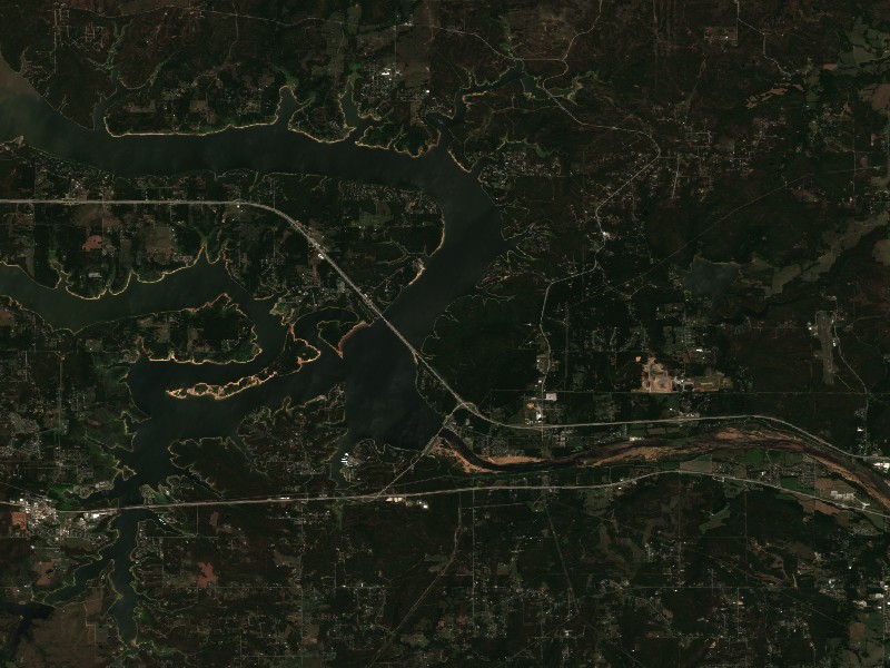
Satellite imagery and indices processed via Copernicus Data Space Ecosystem (CDSE) / Sentinel Hub API. Data reflects actual surface conditions at the time of orbital passage.
Derived from Band 4 red reflectance across open water pixels. Low reflectance indicates minimal suspended silt and high underwater visibility for angling and navigation.
Normalized Difference Chlorophyll Index (NDCI: 0.097) measures phytoplankton concentration using Red-Edge (B05) and Red (B04) bands to detect early bloom development before surface scums appear.
Normalized Difference Water Index (NDWI) contrasts Green and Near-Infrared spectra to map shallow shoals, sandbars, and exposed islands (like Sometimes Island on Travis or Wood Island on Texoma).
Recommended Gear for Current Conditions
Algorithmically matched to today's water temperature (81°F), lake elevation, and weather forecast.
Airhead Super Mable 3-Rider Towable Tube with Dual Tow Points
Warm 81°F surface water offers perfect conditions for wake tubing, chariot riding, and family towing action.
Onyx A/M-24 Deluxe Automatic/Manual Inflatable Life Jacket (USCG)
Lightweight, comfortable low-profile design that automatically inflates upon immersion while allowing full arm mobility for driving and casting.
Earth Pak 20L Waterproof Heavy Duty Dry Bag with Phone Case
500D commercial grade PVC keeps phones, dry clothes, first-aid, and towels 100% dry through boat wake spray and sudden rain squalls.
Garmin Striker 4 Fishfinder with CHIRP Sonar & Dual-Beam Transducer
High-frequency CHIRP sonar pinpoints submerged humps, river channel dropoffs, bait balls, and suspended gamefish with crisp target separation.
Commercial Marinas & Featured Partners on Keystone Lake
Verified marine operators, boat slip facilities, and licensed guide services.
⚓ Crosstimbers Marina
Full-service marina facility providing vessel mooring, guest slip rentals, marine fuel dock, and lakefront boater amenities on Keystone Lake.
⚓ Crystal Bay Marina
Full-service marina facility providing vessel mooring, guest slip rentals, marine fuel dock, and lakefront boater amenities on Keystone Lake.
Charter Guide or Boat Rental on Keystone Lake?
Reach thousands of visiting boaters and anglers checking live water levels, surface temperatures, and ramp conditions before heading to Keystone Lake.
Living on Keystone Lake
Considering buying a lake cabin, dockable waterfront home, or retirement property on Keystone Lake? Water levels, dock stability, and flood pool buffers are critical factors in waterfront valuation.
Crucial flood protection gate for the Arkansas River basin and Tulsa metropolitan area.
Mannford, OK
Directly on the south shore, featuring New Mannford Ramp, lakeview neighborhoods, and marina amenities.
Sand Springs, OK
Historic Arkansas River community with fast expressway commute into downtown Tulsa and Keystone access.
Cleveland, OK
Northwest gateway where the Arkansas River feeds the reservoir, offering quiet rural acreage.
Prue, OK
Quiet Osage County shoreline enclave overlooking panoramic central pool waters.